A SESAR walking tour on virtualisation took in developments on display at the DLR, Frequentis and Indra stands.
SESAR’s Adriano Acanfora – the host of the tour – set the scene by explaining that the ultimate goal is a digital European sky that is efficient, resilient and sustainable. An important step on this path is the creation of virtual control centres that decouple the technology from the air traffic controller (ATCO).
At the Indra stand, it was explained the Virtual Centre with Triangle Architecture and Cyber Resilience (VITACTY) project and its involvement in iSNAP, which is the name for the technological evolution of the iTEC SkyNex platform.
VITACY will separate and provide data related to specific functionalities, such as arrival management (AMAN), time-based separation (TBS) and conflict detection. Validation tests in AMAN and TBS are ongoing and anticipated benefits include cost savings through the greater rationalisation of services. VITACY will also open the door for competition in data provision.
iSNAP, meanwhile, will advance iTEC communications to a more robust model, updating the ATM system supervision and data recording functions. The calculated trajectory of each flight plan will also be improved thanks to information received directly from the aircraft.
At Frequentis, it was explained that moving the technology into a data centre away from the controller has enormous advantages for resilience. There could be a second or third operational centre, for example, and even a second data centre. Aside from strengthening contingency plans this enables updates to be easily undertaken. The theory is that, ultimately, control of an airspace sector can be performed from anywhere in Europe, realising the digital sky dream.
The final element in this idea was described at the DLR stand. The Increased Flexibility of ATCO Validations (IFAV3) project will fill an important gap in the virtualisation concept. As it stands, ATCOs are endorsed on a specific sector following months of on-the-job training, which is expensive in terms of time and money and limits operational agility.
The idea is that through support tools, procedural changes, competency-based training, smart sector grouping and automation, ATCOs can be endorsed for multiple sectors. For example, tools might include a heat map that predicts future traffic density while procedural changes will move towards standardisation. User cases will also involve remote towers.
ATCOs that can move across sectors will complement the idea of virtual centres. It will make better use of existing capacity, improve resilience, enhance rostering possibilities and lower training costs.
FREQUENTIS X10 prepares Luxembourg Airport for future-ready voice communications
Frequentis X10 voice communication system (VCS) to modernise tower and approach infrastructure for air/ground and ground/ground communications
X10 VCS provides a market-leading approach to cyber security and the most intuitive Human Machine Interface (HMI) for the air traffic controllers
Luxembourg Air Navigation Administration (ANA) has selected the Frequentis X10 VCS to modernise the voice communication system infrastructure for its tower control and approach centre at Luxembourg Airport.
X10 VCS is a fully software-based and air traffic management (ATM)-grade IT VCS, suited for both virtualised and conventional airspace. The offered solution provides all essential features for reliable air/ground and ground/ground communications. It provides the resilience and cyber security required of a system built for safety-critical ATM, with a unique multi-redundancy design, as well as the ability to adapt capacity depending on demand.
“The X10 is our next-generation VCS system, designed with operational agility and a future-proof update strategy that will ensure business continuity throughout ATM operations,” says Hannu Juurakko, Frequentis Executive Vice President ATM Civil and Chairman of the ATM Executive Team. “Having worked with Luxembourg ANA for over 20 years, we are dedicated to supporting them with the changing demands of their airspace, providing the most modern VCS on the market with a clear path to a future unified communication solution.”
Frequentis X10 VCS adds value to every air traffic control operation, making it particularly strong from the air traffic controllers’ perspective. The loading of roles and the handling of scenarios are easy and intuitive, without any disruption to service provision. The advanced user functions, including sensitive and gesture-based operation, ensure any clutter on the operator panel is eliminated.
“As a long-term customer of Frequentis for many decades, we trust their solutions implicitly and are looking forward to this VCS modernisation to support our airspace with managing increasing demands, as well as preparing us for future requirements and ensuring the highest level of safety for our customers,” says Claudio Clori, Director, Administration of Air Navigation.
Leidos establishes Air Traffic Management Center of Excellence in Indo-Pacific Region
Leidos, a FORTUNE® 500 innovation company, has announced the establishment of an Air Traffic Management (ATM) Research and Collaboration Center in Singapore to keep pace with the rapidly evolving demands of global aviation. This operational expansion is intended to deliver safe and efficient solutions to the Civil Aviation Authority of Singapore (CAAS) and Air Navigation Service Providers in the Indo-Pacific region.
“This expansion represents the next step in delivering the highest level of airspace services to the Indo-Pacific region,” said Ed Sayadian, Leidos senior vice president, transportation solutions. “We are excited to grow our regional team with innovative thinkers who will engage with a broad base of global air transportation stakeholders to advance critical air traffic management capabilities.”
Axel Bensch, pictured below, has been appointed to lead operations in the region as well as the new center, bringing with him more than 25 years of commercial aviation and ATM expertise. Under his leadership, the Center will collaborate with regional universities, research institutes and industry partners to augment international air traffic solutions and enhance operations in the region leveraging Leidos’ 65-year history of supporting air navigation service providers and their mission.
The Center will also provide collaborative research and development for advanced capabilities in trajectory-based operations and international air traffic flow management through Skyline-XTM – Leidos’ comprehensive air traffic management platform.
For more on Leidos’ extensive solutions in air traffic management, visit www.leidos.com/ATM.
New competition for airspace means new rules
Introduction
Competition for airspace around the world is fiercer than ever and air traffic is becoming increasingly complex to manage, as the aviation industry continues to find new ways to use the air domain in service of human endeavour.
At the same time as regular use of the airspace below 500 ft is increasing (think drones and passenger carrying air taxi / urban air mobility operations), non-aircraft (both physical and non-physical) airspace users are asserting their own right to use, affect or occupy a precious piece of the sky, putting even more pressure on the systems we need to ensure the safe, efficient and regular use of airspace.
The new competition
In the past, the airspace below 500 ft has been the domain of the specially trained who are adept at avoiding the ground and myriad of other hazards that concentrate just above the intersection of earth and sky. Aerial application and firefighting, search and rescue / aeromedical activities and low-level military operations are just some of the activities that necessarily occur in this hazardous environment. It is also where all aircraft are exposed to the highest risk of an accident – during take-off and landing.
In recent years this airspace has become increasingly occupied by millions of drones in the pursuit of leisure, commerce, agriculture, research, survey, medical and sometimes other more nefarious activities.
Meanwhile, the airspace above 500 ft, which has traditionally been the preserve of aircraft and the occasional tall structure in more developed areas, will soon be intruded upon by millions of wind turbines and supporting meteorological monitoring masts in areas close to and remote from built up areas, both on and offshore, as the world transitions from fossil fuels to renewable energy in pursuit of net zero carbon emissions. These tall structures, extending towards 1000 ft high and beyond, occupy airspace and intrude upon flight paths that are relatively undefended from potentially adverse impacts.
And now, with the imminent introduction of commercial, passenger carrying, air taxi / urban air mobility operations which will operate predominantly in the lower levels of airspace including below 500 ft, the global airspace and air traffic management sector is striving to establish a safe and efficient operating system that will accommodate these new users within a regulatory framework that is already struggling to keep up with technological advancements.
Changing the rules
Changing the rules will involve all elements of the air traffic management system, including separation standards, air traffic control, flight path design and surveillance systems. We’ll also need to improve airspace protection arrangements.
Separation standards. The commercial success of air taxi / urban air mobility operations relies in part on the value proposition that they will be able to get people from one place to another faster for roughly the same price as land (or sea) based transport options. To do this, they want to be able to fly between origin and destination without any delay. Given operations are likely to be conducted within or through controlled airspace with restrictive separation standards, the challenge is to achieve efficiency outcomes through reduced separation standards between these airspace users without compromising safety.
To do that we need to know with a high level of accuracy and certainty where each aircraft is, where it’s going, its planned flight path and operating parameters, and work out a way to enable these operations, dynamically and in real time.
Air traffic control. The traditional concept of a human air traffic controller managing a sector of airspace, monitoring and directing the various aircraft for which they are responsible as they move along their flight paths, supported by pre-programmed computer-based logic, will almost certainly persist for upper level and terminal airspace operations.
Low level airspace, though, will need a new approach to air traffic management – hence the brilliant and extensive work currently underway to develop and implement unmanned air traffic management (UTM) systems based on artificial intelligence that is supported by human monitoring and intervention.
New flight paths. Air taxis and other high frequency low level airspace users will also expect dedicated flight paths to be established, often within the most congested piece of the sky. The right to relatively unfettered occupation of certain parts of the airspace is being asserted as a fundamental requirement for the success of these future operations and is a real challenge to traditional airspace control arrangements.
Surveillance systems. Traditional aircraft surveillance systems are designed to be ground-mounted and look up, continuously searching for and attempting to interact with small aircraft specks as they traverse the skies above.
With aircraft equipped with appropriate onboard systems, cooperative interaction and satellite-based sensors, surveillance systems will be better able to look down and ‘see’ these aircraft at all levels from an even greater distance, providing better resolution of the airspace situation to airspace controllers, whether human or artificial.
Airspace protection. There will need to be more robust mechanisms to apportion and adjudicate on the rights of the various flying and non-flying airspace users, as taller structures and non-physical airspace users compete for parts of the sky towards and beyond 500 ft above the ground and more aircraft occupy the lower levels. An infringement of a flight path or obstacle protection surface can be resolved if the flight path or protection surface is modified, thereby preserving appropriate safety margins. But these changes almost always come with a compromise to efficient aircraft operations, and there is a lack of robust or universal guidance about how to effectively and fairly balance these competing interests.
Conclusion
Increased competition from aircraft and non-aircraft (physical and non-physical) for constrained low-level airspace means that we need new rules to ensure safe, efficient and regular aircraft operations while permitting desired development and technological advancements. While there is plenty of work to do, with the energy being directed to this task, the outcome is exciting and seems assured.
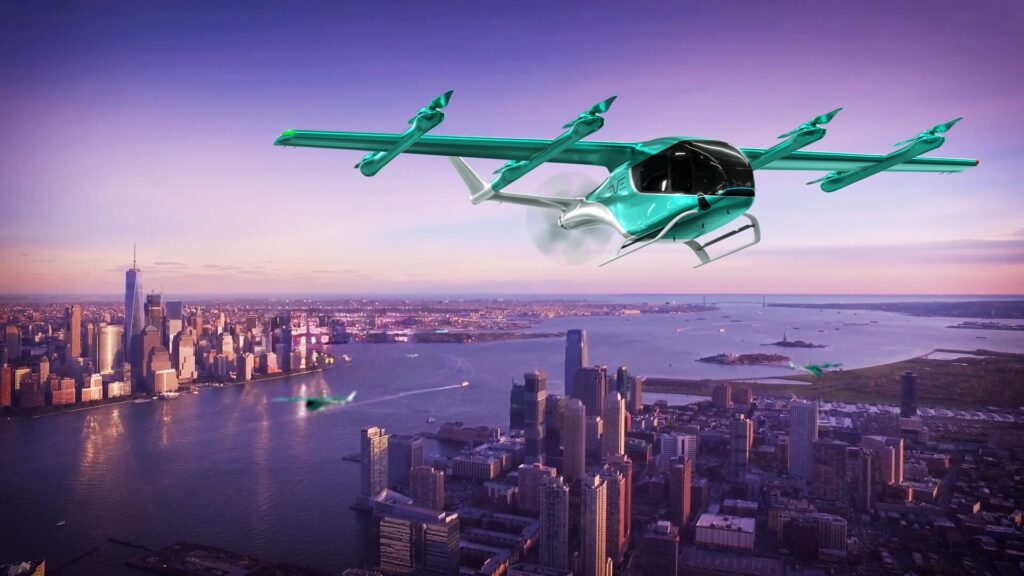
The Urban Air Traffic Management Concept
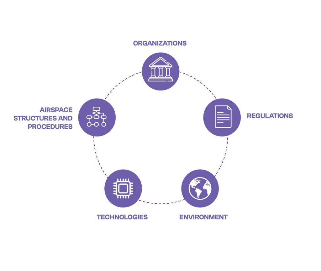
Urban ATM is the collection of systems and services to support the integration of all operations in the urban airspace environment, including Regulations, Organizations, Airspace Structures and Procedures, Technologies, and the Environment. The term “urban” is used to signify the area where new advanced high-integrity ATM services are likely to be required to support the integration of electric vertical take-off and landing (eVTOL) aircraft and drones.
Given the need for eVTOLs to be integrated with other aircraft from initial operations, Eve believes that the introduction and evolution of this new type of aircraft will be the catalyst for a new approach to managing traffic in urban environments.
Urban ATM will support the integrated operation of initially piloted Urban Air Mobility (UAM) aircraft and other airspace users in low-level airspace, enabling the optimized performance and safety of UAM operations and providing a roadmap toward the integration of autonomous aircraft.
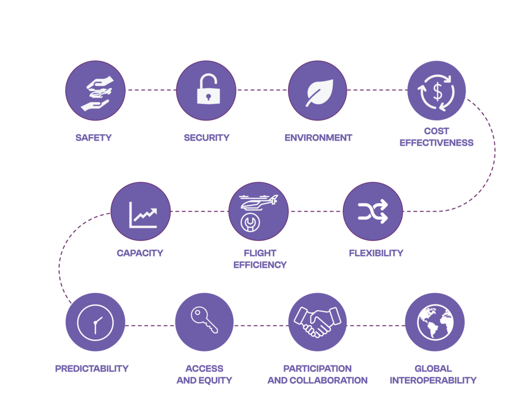
Optimizing the performance of operations is not limited to just separation services but will include consideration of all ICAO Key Performance Areas (Safety, Security, Environment, Cost Effectiveness, Capacity, Flight Efficiency, Flexibility, Predictability, Access & Equity, Participation & Collaboration and Global Interoperability).
Initial Urban ATM services may focus more on performance areas such as flight efficiency, flexibility, predictability, and participation and collaboration. Safety will be achieved through traditional ATM arrangements and pilots conducting operations under Visual Flight Rules (VFR).
Urban ATM services that enable the integration of all airspace users will differ from those required for UAS Traffic Management (UTM) in terms of functionality and level of integrity. They will support piloted, remotely piloted, and autonomous aircraft operations. Given their proximity, Urban ATM services will need to integrate with both traditional ATM and UTM services. It is expected that UTM services will continue to be utilized for segregated uncrewed aircraft systems operations (for example, in areas below 500 ft).
Eve sees the evolution of UAM operations occurring over several horizons, where different features for operations will take place.
Implementation of existing ATM concepts (e.g. VFR routes)
New vertiport and fleet operations planning, information sharing, flow management, and situational awareness Urban ATM solutions (provided by ANSPs or other parties)
Horizon 2 – UAM Scale
Expected deployment timeline: late 2020s
UAM aircraft operations where current ATM procedures and technologies are insufficient to support the demand for operations.
New ATM solutions will be needed to enable the UAM industry to scale
Horizon 3 – Integration of uncrewed passenger carrying aircraft
Expected deployment timeline: early to mid-2030s
A mix of piloted, remotely piloted and autonomous UAM aircraft operations with other airspace users
Integration of UTM and Urban ATM concepts
Tomorrow, we will introduce Eve’s work to develop technology solutions to support initial eVTOL operations.
For more information, visit us at the Atech stand F22
About the author: Rob Weaver is the Urban ATM Global Business Development Lead for Eve Air Mobility, the Embraer backed start-up dedicated to accelerating the global UAM ecosystem. He also leads Entry Into Service planning for Eve’s eVTOL aircraft in Australia.
Rob has worked with Embraer-X and Eve on new ATM concepts to support UAM since 2018. Previously he was Executive General Manager Safety, Environment & Assurance at Airservices Australia, where he was a member of the Executive for six years. He has also worked for the UK’s Air Navigation Service Provider and holds a PhD in safety critical systems from the University of York.
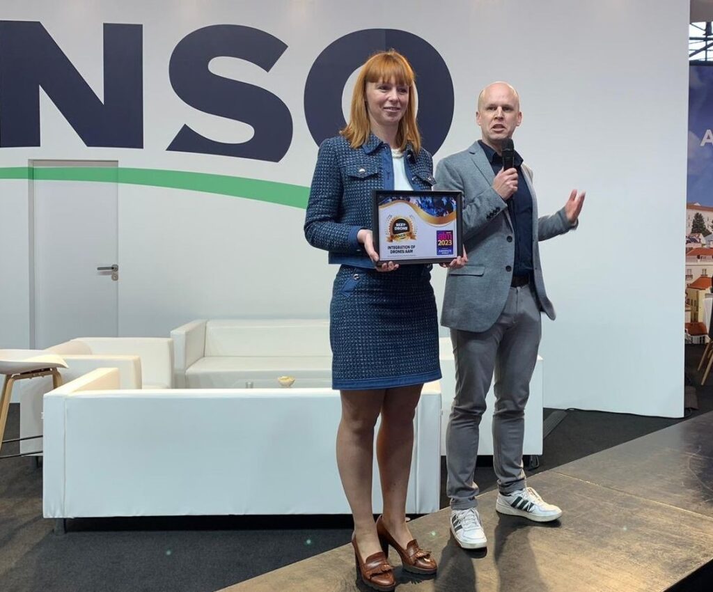
SkeyDrone honored at Air Traffic Management Awards 2023 for Drone Detection solution
Geneva, March 20, 2024 –At Airspace World 2024 in Geneva, SkeyDrone has been honored with the runner-up award in the category “Integration of drones/AAM” with our Drone Detection as-a-Service solution. This recognition, presented by Air Traffic Management Magazine in collaboration with CANSO, highlights SkeyDrone’s commitment to advancing drone technology in aviation.
The Air Traffic Management Awards aim to encourage pioneering concepts and acknowledge significant achievements by leaders, initiatives, and organisations in the aviation industry. This year, the “Integration of Drones/AAM” category saw a record number of entries, making the competition tougher than ever.
SkeyDrone’s award-winning Drone Detection as-a-Service solution boasts an exceptionally high detection rate and effectively distinguishes authorised drone operations from unauthorised drone activities. Since its successful deployment at events like Tomorrowland in 2023, where it helped confiscate 12 illegal drones, the solution has been adopted by many organisations safeguarding critical infrastructure.
Expressing pride in SkeyDrone’s achievement, Hendrik-Jan Van Der Gucht, Managing Director of SkeyDrone, emphasized the company’s unique position as the only startup recognized at the awards. “Winning this award among tough competition is a testament to the dedication of the SkeyDrone team. We’re proud to be the only startup honored, showing our commitment to innovation in aviation.”
note to the editors
Media requiring additional information can contact Nele Coghe, Head of Marketing at SkeyDrone via nco@skeydrone.aero and +32 473 76 90 16.
About SkeyDrone
SkeyDrone is a joint venture between the Belgian Air Navigation Service Provider skeyes and Brussels Airport Company. The company’s mission is to provide end-to-end solutions for business needs related to the use of uncrewed aircraft (drones). SkeyDrone offers solutions for lower airspace monitoring, management of and protection against drones for authorities and geo-zone managers, UTM/U-space & consultancy services for drone operators and business integration services for companies. Playing a pivotal role in the implementation of U-space in Belgium, SkeyDrone is on track to make history by becoming one of the first U-space service providers in Europe.
EagleShield – CUAS for Airports- UAS fast detection & identification a must
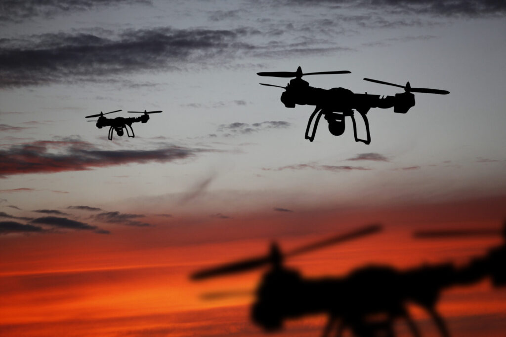
The increase in the number of drones flying around the world has been exponential. In less than a decade, drones have gone from an expensive technology available to a few, to a mainstream toy or capability within reach of anybody.
Knowing what is flying and where, be it collaborative or non-collaborative is a must. Unmanned aircraft systems (UAS) represent a significant threat for airports, airlines and, ultimately, air passengers worldwide.
A few incidents have already demonstrated how even just the presence of a drone near an airport’s glidepath – let alone a collision – can affect airport operations. Hours of closures, hundreds of delayed or cancelled flights, dissatisfied passengers, all incur considerable costs for both airlines and airports. Incidents that may also adversely affect reputation.
Yet, today radar technologies currently deployed at most airports around the world are not designed to deal with UAS, in particular micro (2kg) and mini (2-20kg) drones. These drones feature a very small Radar Cross Section (RCS) capable of flying at low altitudes, high speeds and unpredictable patterns, making them objects particularly difficult to detect.
No one sensor can tackle the UAS threat alone, especially as the menace from non-collaborative drones – that is, drones flying without transmitting any information allowing their identification – continues to increase.
The right combination according to airport needs lies in the ability to design a bespoke solution that can efficiently and effectively detect, identify and track any UAS.
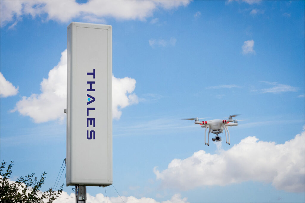
To address this fast-emerging drone threat we have developed the EagleShield – CUAS for Airports – (Counter – Unmanned Aerial System). A multi-sensor solution featuring its core the Gamekeeper holographic radar, enabling, long-range detection, identification and tracking of both collaborative and non-collaborative drones, protecting airport glidepaths for safer take-offs and landings.
EagleShield -CUAS for Airports– is a multi-layered and scalable solution comprising: a Gamekeeper holographic radar, long-range electro-optic (EO) sensors, Radio Frequency Direction Finders (RF) and remote ID sensors. The Gamekeeper radar features a 7.5km detection range and a 90° horizontal coverage, and the long-range EO sensors are crucial to detect non-collaborative drones – that is, drones flying without transmitting any information allowing their identification.
There are two key advantages to having a multi-layered drone detection system: The fusion of multiple sensors increases detection while also reducing false alarms, making sure that flight operations stay on time and are not interrupted by false alarms. In addition as a system of system solution, EagleShield -CUAS for Airports– is sensor- agnostic. The Gamekeeper radar and network infrastructure provided by Thales can integrate a large range of EO sensors, RF and/or remote ID sensor solutions according to airport operational needs. This offers a high level of flexibility to airports large or small around the world and ensures flight operations stay on time and remain secure.
EagleShield -CUAS for Airports– provides a holistic, long-range protection of the glidepaths and airport vicinity against non-collaborative and collaborative UAS. With 3 demonstration centers in the world, discover the demo for yourself.
GoDrone 2.0 – Drone Flight Planning App gets a new look!
Netherlands favourite flight planning app to relaunch with enhanced user experience and industry-ready flight planning tool set
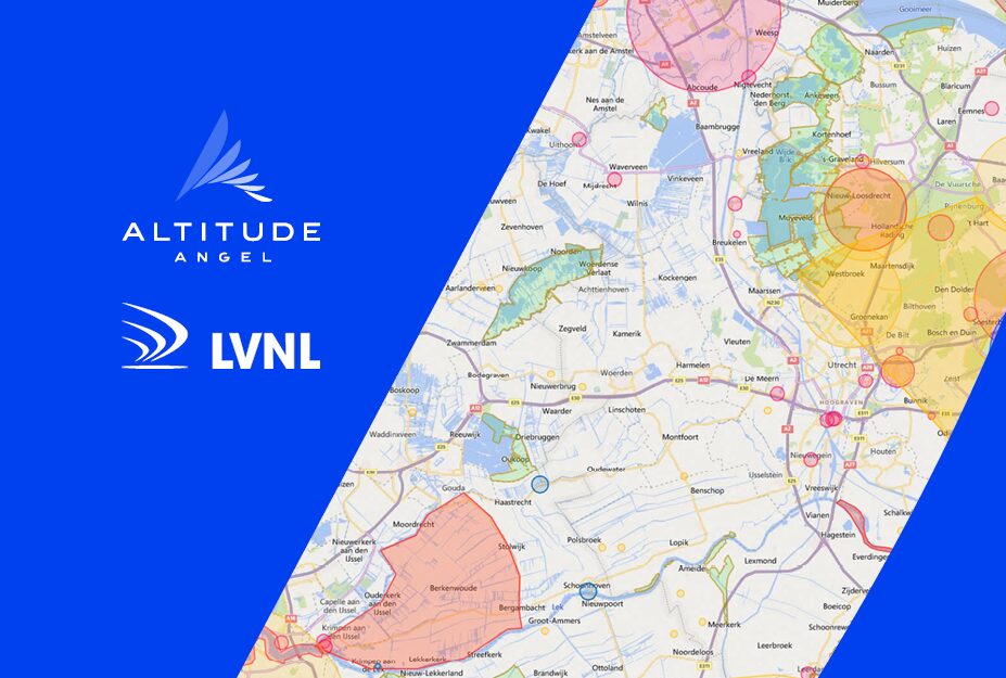
Netherlands ANSP LVNL and Altitude Angel, the world’s most trusted UTM (Unified Traffic Management) technology provider, have chosen the second day of Airspace World to announce the release of a new and improved version of the popular flight planning tool, GoDrone, bringing a host of new features which will give users an even greater understanding of the country’s airspace and access to it.
Designed and powered by Altitude Angel, GoDrone has established itself as the flight planning app for professional and recreational drone pilots across the Netherlands since its launch in April 2020.
“Planning is central to all commercial drone operations within a civil CTR, and any operator should start their flight plan with GoDrone, which is why we’re continuing to invest in the app,” said Wouter Pekela, Program Manager Unmanned Aviation, LVNL.
The new version of GoDrone, which begins rolling out in Q2 for both iOS and Android, is the most extensive update since the app was first launched and includes several enhancements and exciting new features.
The suite of updated features includes enhanced integrated flight planning, advanced flight plan drawing tools, and approval services – the ability to request access to fly digitally in airspace such as an airport CTR– through the app.
These updates make the app more user-friendly and intuitive for novice pilots, whilst providing several business-critical services for more experienced and professional operators.
In addition to enhanced integrated flight planning & drawing tools, GoDrone also includes new ‘pilot profiles’ and aircraft management, which provides users with the ability to log drone operator profiles, hours flown, and airframe hours used. These features are particularly useful for professional drone operators who may be required to manage or evidence their operational experience and help in managing airframe service intervals and the like.
Other upgrades and new features also include:
New UXUI -Completely rebuilt modern user interface.
New Accepted and Approved statuses, allowing GoDrone users to be able to receive more digital updates and information on their mission requests.
New Map Types including Satellite Maps to help you plan your drone flights safely and efficiently.
Advanced filter setup allows you to fully customise your airspace to suit your preferences, including political border and NOTAM’s.
Airframe Hanger – Ability to now input and save all of drones directly in the GoDrone APP.
GoDrone Operator Portal Integration – Information, edits and missions are natively linked between the GoDrone APP and Operator Portal.
Ground Hazards – Understand ground hazards in greater details, The Godrone now displays a list of ground hazards in the pre-flight report, each is clickable, providing users with more detailed information.
New Area reports feature which gives you a simple-to-understand view of where you can fly safely, where you need to exercise caution or areas that are prohibited.
Enhanced Security (Biometrics) Utilise the latest security features on your phone or tablet, including eye and fingerprint access.
New flight plan tools- Maximise your flight planning by using advanced drawing tools, or upload files directly from your device.
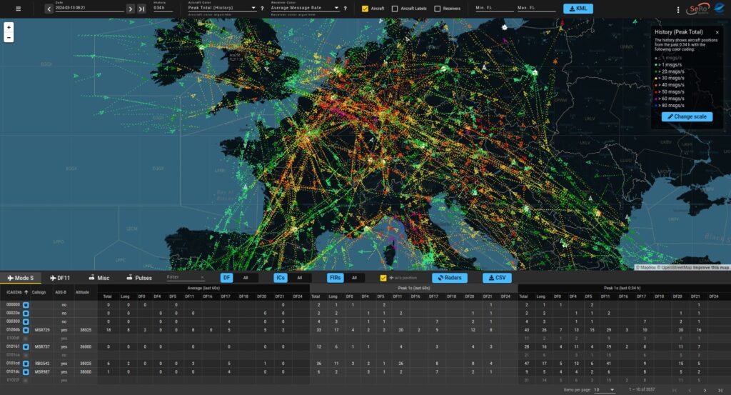
SeRo Systems awarded EUROCONTROL contract for1030/1090 MHz data collection service
Follow-on to original contract awarded in 2020.
EMIT platform provides comprehensive monitoring and analysis services
SeRo Systems, a leader in air traffic surveillance security and monitoring solutions, announced today that it has been awarded a 5-year follow-on contract for spectrum monitoring services from EUROCONTROL, the civil-military organization dedicated to supporting European aviation.
Under this contract, SeRo will continue to provide real-time datacollection and processing services, including host/data collection, preprocessing and a user interface, for the European Monitoring of Interrogators and Transponders (EMIT) platform. Developed bySeRo in 2020, EMIT provides comprehensive monitoring services, collects and manages the vast amount of data from the Europe-wide ground network of 1030/1090 MHz receivers, and combines the data feeds into a single feed. The system also processes the data, enabling automated detection and analysis of surveillance anomalies.
“We are honored to extend our partnership with EUROCONTROL to continue delivering critical spectrum monitoring services that enhance airspace safety and efficiency,” said Dr. Matthias Schäfer, managing director of SeRo Systems. “This contract leverages SeRo’s decade of experience in Big Data, high TRL surveillance data collection, and processing architecture, to help detect and analyze threats, including spectrum congestion or equipment malfunction. SeRo is committed to developing solutions that make air surveillance more secure and robust for stakeholders in Europe and around the world.”
“This system and SeRo have been an important part of our efforts to uphold the integrity of the CNS infrastructure and reduce spectrum congestion in our airspace,” added Petr Jonáš, EUROCONTROL ATM/CNS Expert. “Since 2020, EMIT has helped the European air traffic surveillance community not only monitor and manage frequency congestion but also detect and investigate incidents as well as avionics, transponder, and ground radar issues.”
Since its launch, EMIT has collected an impressive 3.15 trillion signals and boasts a growth rate of nearly 5 billion signals per day. Its capabilities include processing 90,000 signals per second during peak traffic hours, ensuring comprehensive monitoring and automated detection of anomalies within the European surveillance infrastructure. SeRo’s proprietary deduplication algorithm ensures precise data analysis, while features such as online analysis, data archiving, and sensor operations monitoring enhance the system’s effectiveness and usability.
NATS crowned a winner at the prestigious Air Traffic Management Awards
The awards were held at CANSO Airspace World in recognition of the significant achievements by leaders, initiatives, and organisations in the air traffic management industry.
NATS was a winner in the Reimagining ATM Operations category which sought to recognised new approaches to airspace design, route optimisation, airspace classification and dynamic airspace management.
The West Airspace Deployment was one of the largest and most technically complex airspace changes NATS has ever delivered. A project that was the culmination of more than five years of development, it was successfully implemented on 23 March 2023.
Spanning 54,000nm2, the airspace structure above 7,000ft over southwest England and Wales was transformed to support the future of air travel and enable simpler, safer and more efficient flying. This once in a generation airspace upgrade forms an important part of the aviation industry’s roadmap to deliver a more sustainable future for air travel and supports the UK government’s Airspace Modernisation Strategy.
In a first for the UK, two separate airspace change proposals to introduce Systemisation and Free Route Airspace (FRA) operations were deployed simultaneously in a section of airspace that hosts some of the busiest routes for international flights to and from major UK airports.
The Digital Transformation in ATM category looks to recognise those working to revolutionising ATM for increased efficiency, safety, and capacity. NATS, LVNL, Leidos UK and Think Research were runners up for the deployment of Intelligent Approach, which went live at Amsterdam Airport Schiphol on 26 January 2023 following three years of close collaboration.
Intelligent Approach is an aircraft spacing tool developed by NATS and Leidos UK that allows air traffic controllers to improve the consistency of spacing between arriving aircraft. That helps maximise runway capacity, reducing delays and emissions and – importantly for LVNL – the noise impact on local residents.
Upon going live, Intelligent Approach immediately delivered up to six additional movements for each of Schiphol’s runways, not only delivering much needed tactical capacity but also allowing reduced usage of the airport’s most noise sensitive runways.
NATS was also shortlisted in the Integration of Drones and Advanced Air Mobilitycategory, recognised for its work in Project AMEC – Air Mobility Ecosystem Consortium.
Last year, NATS conducted the UK’s first major air traffic management simulations for Advanced Air Mobility (AAM), demonstrating how eVTOLs could one day be safely integrated with conventional air traffic.
The simulations were the culmination of three years of work creating the required infrastructure and processes for eVTOLs to safely operate in a complex airspace environment. The work has brought new airspace users a step closer to safely integrating with existing air traffic in the UK.
Project AMEC aims to demonstrate the commercial and end to end operational viability of Advanced Air Mobility in the UK. It is jointly funded by UKRI (UK Research and Innovation) Future Flight Challenge and is made up of NATS, Vertical Aerospace, Virgin Atlantic, AtkinsRéalis, Skyports, Connected Places Catapult, Cranfield University and WMG – University of Warwick, Bristol Airport, London City Airport and Heathrow Airport.